Wednesday, December 4, 2013
Cold Facts and Coastal/Oregon Snow
We are now experiencing our coldest weather since January, with temperatures falling below zero in "favored" spots of eastern Washington and Oregon. Snow is coming to the Northwest during the next two days, but unfortunately will miss most of Washington.
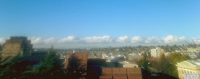
But first, this morning there was an unusual sight: a line of clouds down the center of Puget Sound (see picture from the UW web cam facing the Olympics). The cause? The cold air!
Last night we had a land breeze on both sides of the Sound. A land breeze occurs when the land is colder than the water, generally by at least 5-10F. Last night that happened: the water temperature is roughly 50F while the land temperatures dropped into the 20s. Air from the cold land moves towards the water. The land breezes on both sides of the Sound converged over the central Sound and rose, producing a line of clouds. You can see a hint of this from the winds taken over Puget Sound this morning by the Washington State ferry traveling between Edmonds and Kingston around 8:30 AM (see below)
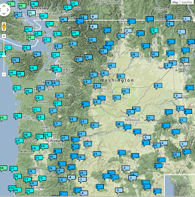
The next map shows you the low temperatures across the region last night. Some of the coldest temperatures were at Pullman (-3F) and in the nearby Blue Mountains. Why was it so much colder at Pullman than say Moses Lake? The answer is found in a satellite image taken this morning: Pullman had snow on the ground (see picture below).
Snow covered NW Oregon and SE Washington. Snow is associated with cold temperatures: it reflects the sun during the day and is a very effective emitter in the infrared. And it can insulate the lower atmosphere from warm ground.
Now let's talk forecast. An upper level trough is moving southward around the high, causing upward motion, clouds, and precipitation (see map at 10 PM Thursday at 500 hPa). Associated with the
upper trough is a low center at and near the surface (see surface map).
The frustrating thing for snow lovers is that the low is passing too far offshore to bring snow to most of Washington, perhaps light snow on the WA coast and moderate snow over central and southern Oregon as the low swings eastward south of us. If the low was one hundred miles to the east and Seattle would be white. Here is the projected 48h snowfall ending Saturday at 4 AM. Oregon is nearly COMPLETELY covered with snow, with the exception of Portland and Columbia Gorge. Northern CA gets snow. Just not fair.
Then you expect dry and cold conditions through the weekend. One notable weather feature: very strong winds are expected on Friday and Saturday downstream of the Fraser River Gap--we are talking Bellingham, San Juans, and the neighborhood. Here are the gusts at 4 PM Friday. 50 kts over the Strait of Georgia from the NE and strong easterlies over the Pacific and Strait.
And expect windy conditions along the western slopes of the Cascades, particular in Enumclaw, Black Diamond, the Issaquah Highlands, and North Bend.
Announcement
Are you in venture capital/private equity and have an office in the Bay Area, or knows someone who does?
If so, I have a question for you. Please send me an email (cmass at uw.edu) ....thanks, cliff
Subscribe to:
Post Comments (Atom)


No comments:
Post a Comment