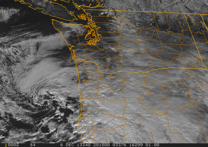
Here is the visible satellite around noon on Friday. You can see the swirl of clouds associated with the low off of northern Oregon.
.jpg)
Here are a few cam shots on I5 near Eugene--this does not look like pleasant travel.


As the low moved south of Washington, easterly flow has increased over Washington State--thus air is approaching the Olympics through depth from an unusual direction...from the east. A plot of the winds over Seattle shows this change clearly (time increases to the left, the y axis is pressure, red lines are temperature). The atmosphere is cooling and the winds are easterly to 700 hPa (roughly 10,000 ft)

With easterly winds approaching the Olympics we are getting an interesting phenomenon...a convergence zone on the WESTERN side of the mountains, with an accompanying band of clouds and even some precipitation. Many are familiar with the Puget Sound convergence zone, in which westerly winds approach the Olympics, move around the Olympics at low levels, and converge over Puget Sound producing a band of clouds and precipitation (see graphic).
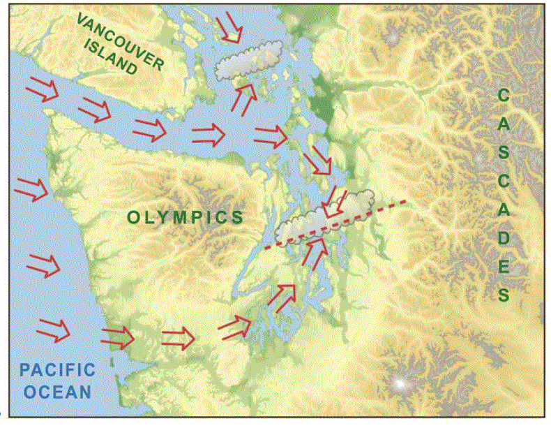
Now reverse the winds and you get a convergence zone to the west of the Olympics.
Let me prove it to you. Here is a MODIS visible satellite picture at 12:10 PM Friday. You see the band of clouds extending southwestward from the Olympics?...that's it. There are also clouds north of the Olympics, produced by the NE flow coming out of the Fraser River gap and passing over Bellingham and the San Juans before being forced to rise by the Olympics. Perhaps some snow over south Port Angeles!

We can get an even better view of the offshore convergence zone by viewing an image from the Langley Hill radar in Hoquiam (see below). An amazing image...you can see a narrow plume of precipitation in the coastal convergence zone.


A model forecast of the winds at 1 PM show the converging winds west of the Cascades.

The coldest temperatures are coming the next two nights...here is the forecast temperature at 7AM Saturday AM. 16-20F over many locations on the eastside of Puget Sound. Single digits and negative temps in eastern WA. Wind chills in the mountains will be brutal...below -20F will not be uncommon. Be prepared if you go up there.

Are you in venture capital/private equity and have an office in the Bay Area, or knows someone who does?
If so, I have a question for you. Please send me an email (cmass at uw.edu) ....thanks, cliff
No comments:
Post a Comment